NG9-1-1: Call Routing & Location Validation
Last month, we discussed the significant changes involved when implementing Next Generation 9-1-1 (NG9-1-1) systems. We discussed the difference between a PSAP that has implemented Internet protocol (IP) capability for the delivery of calls and one that has implemented the NENA i3 specification for NG9-1-1. IP capability is a major and necessary step in the right direction, and each month, more PSAPs are implementing secure IP networks for emergency call delivery. Once in place, these networks can become the backbone for emergency service IP networks for NG9-1-1 systems.
The backbone, however, is only one step toward Next Gen. How those 9-1-1 calls find their way to your PSAP and how locations are deemed “valid” is where the next part of the journey takes us.
Today, for those areas with Enhanced 9-1-1 (E9-1-1), calls are delivered to PSAPs with valid locations provided as ALI, automatic location information. The use of the word automatic can be misleading when trying to understand how call routing and location validation change with NG9-1-1. When a caller dials 9-1-1 today, the phone is not self aware. The phone itself — whether wireless or a landline — does not automatically know where it is or automatically provide its location to the calltaker. After 9-1-1 is dialed, technology takes over in the background, and a search to identify the location begins. While the caller’s voice is being delivered to the PSAP, background processes are automatically querying databases to match the phone number to the specific address with which it’s associated. For a wireless call, the databases may be referencing the tower handling the call. Either way, the phone does not automatically know its own location; the system is automatically “posing the question.” The voice path and the resulting ALI information can be thought of as a two-lane highway that terminates at the calltaker’s workstation. If all goes well, both vehicles on those lanes (voice and ALI) arrive at the same time the calltaker answers the call.
With NG9-1-1, communications devices will pre-validate their location before 9-1-1 is dialed. A caller’s location will be provided to the PSAP automatically on receipt of a call; there’s no parallel query taking place when the call is being delivered. Because there is no automatic parallel query, the term ALI will no longer be used to reference the location information received with a call.
NG9-1-1 calls will be delivered to PSAPs using a network protocol called SIP (session initiation protocol). The SIP signal can be thought of as a single-lane highway. All the media, voice, text and location information will arrive in the same vehicle using that single lane.
The vehicle and highway analogies above are an oversimplification of the complex processes that take place in the background of any 9-1-1 call. The changes coming, however, can be overwhelming, and our learning curve needs to be grounded in easy-to-understand terms before we engage the wealth of new acronyms and concepts coming our way.
Location Validation Function
The current E9-1-1 methodology for validating a location involves several databases. Addresses must conform to the number range and format sanctioned in the MSAG (master street address guide) before they are input into an ALI database and retrieved via ANI for call processing. Many PSAPs work closely with their municipal planning agencies to perform location validation work. When new street records are created, they are validated against the localities’ MSAGs and corrected before being added to the ALI database.
With NG9-1-1, we’ll still rely on databases to validate the format of an address, but it will no longer be a standalone MSAG. The addressing information stored in today’s MSAG will reside in larger geographic information system (GIS) databases. These GIS databases will provide the information necessary to populate servers that will pre-validate a device’s civic location. The GIS database will also populate servers with the identity of the PSAP responsible for each location referenced.
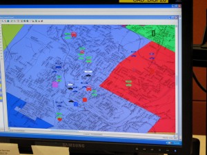
Currently, PSAPs primarily use GIS databases to provide the data needed to display locations and layers on their mapping systems. However, mapping is only one product of the GIS database, and it’s important not to think of these two terms as being the same. GIS is first and foremost a large database that contains a wealth of information about all of the locations within your PSAP’s boundary.
The conventional concept of civic address validation will continue to be used for NG9-1-1. However, the terms ANI, ALI and MSAG will go away because their functions will be replaced by GIS databases and a new location validation function (LVF). The GIS data, once validated, will provide location information that will be used for routing emergency calls to PSAPs. All of these elements working together will form the new emergency call routing function (ECRF) that’s a critical component of NG9-1-1.
GIS will play a significant role in call routing. So it’s critical for agencies to take steps now to assess the accuracy of their GIS databases. The accuracy of jurisdictional boundaries (referred to as polygon layers in GIS) will have a dramatic impact on call routing. Errors and overlap between these boundaries must be identified and corrected.
Agencies should engage in discussion with neighboring jurisdictions to resolve known inconsistencies and any “border disputes.” Many PSAPs employ calltakers and dispatchers who are familiar with the communities served by their agencies. Often, PSAP employees belong to volunteer first response agencies in these same jurisdictions. Using these employees and member agencies to review your data and gain insight into problem areas can provide a PSAP’s GIS authority with a good early indication of how much work lies ahead.
About the Author
Kathy McMahonis APCO’s technical services manager. Contact her via e-mail at mcmahonk@apco911.org.
Originally published in Public Safety Communications, 76(6):22-23, June 2010.


